Key Findings
- Although much has been written about the Punggye-ri Nuclear Testing Facility, identified by North Korea as the “Northern Nuclear Testing Site,” little is known at the unclassified level concerning the facility’s establishment.
- The first open source analysis of declassified satellite imagery by CSIS suggests that construction of the Testing Facility started as early as 1985 to 1986 as part of North Korea’s rapidly expanding nuclear infrastructure at that time.
- Imagery from the Central Intelligence Agency’s (CIA) archives shows early excavation during these years of what would eventually become Tunnels No. 1 and No. 2, the site of North Korea’s six nuclear tests.
- These images manifest early nuclear ambitions by North Korea that arguably went beyond mere experimentation or diplomatic contingency planning (i.e., building capabilities to use as future bargaining chips).
As best as can presently be determined, the decision was reached to commence construction of a nuclear Testing Facility as North Korea’s nuclear infrastructure was rapidly expanding during the 1980s. Although why the site 17 kilometers northwest of the town of Punggye-ri, Hwasong-gun, Hamgyong-bukdo, was chosen is unknown, the most probable reason is a combination of both the site’s remoteness and suitable geology.1
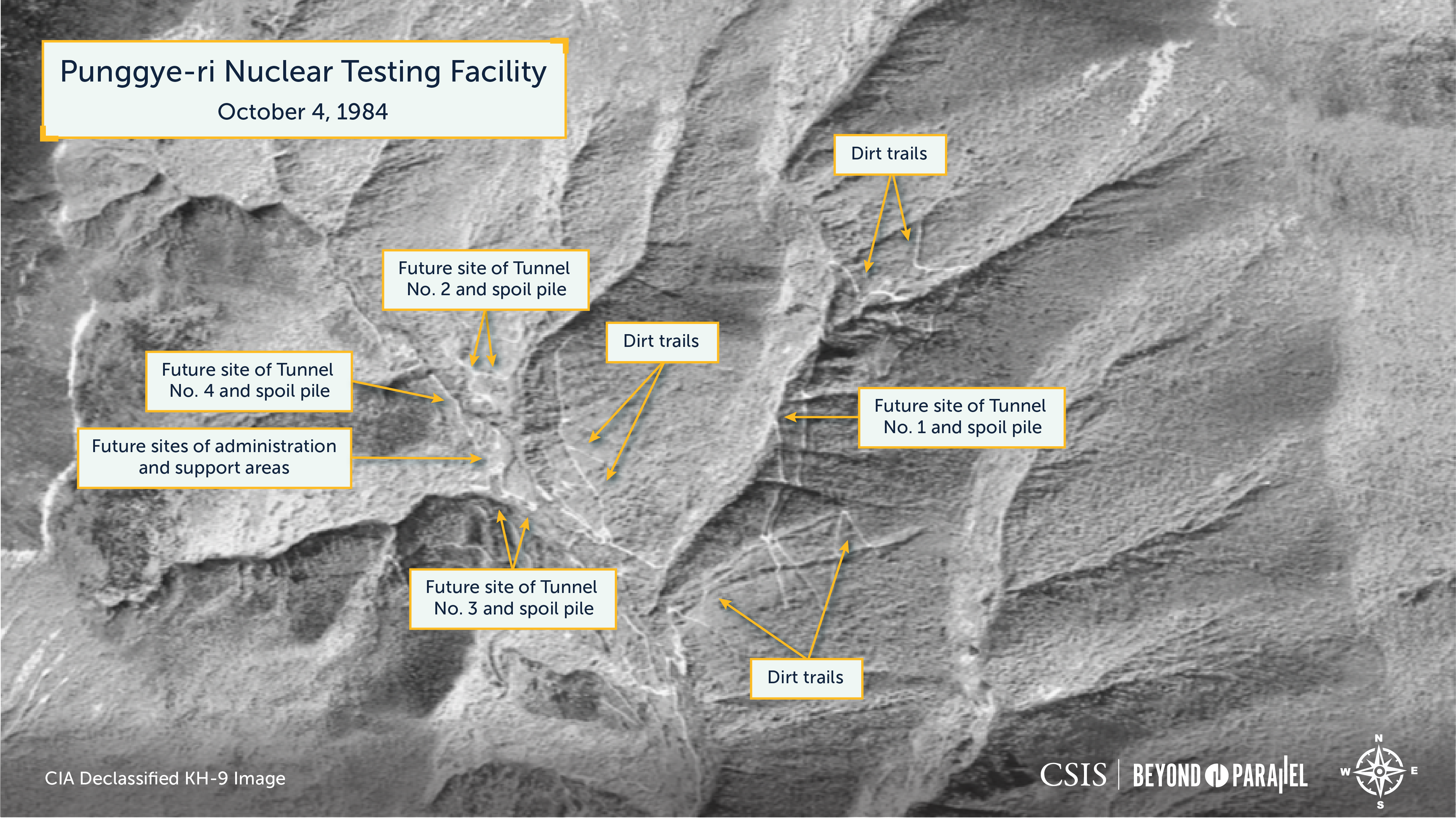
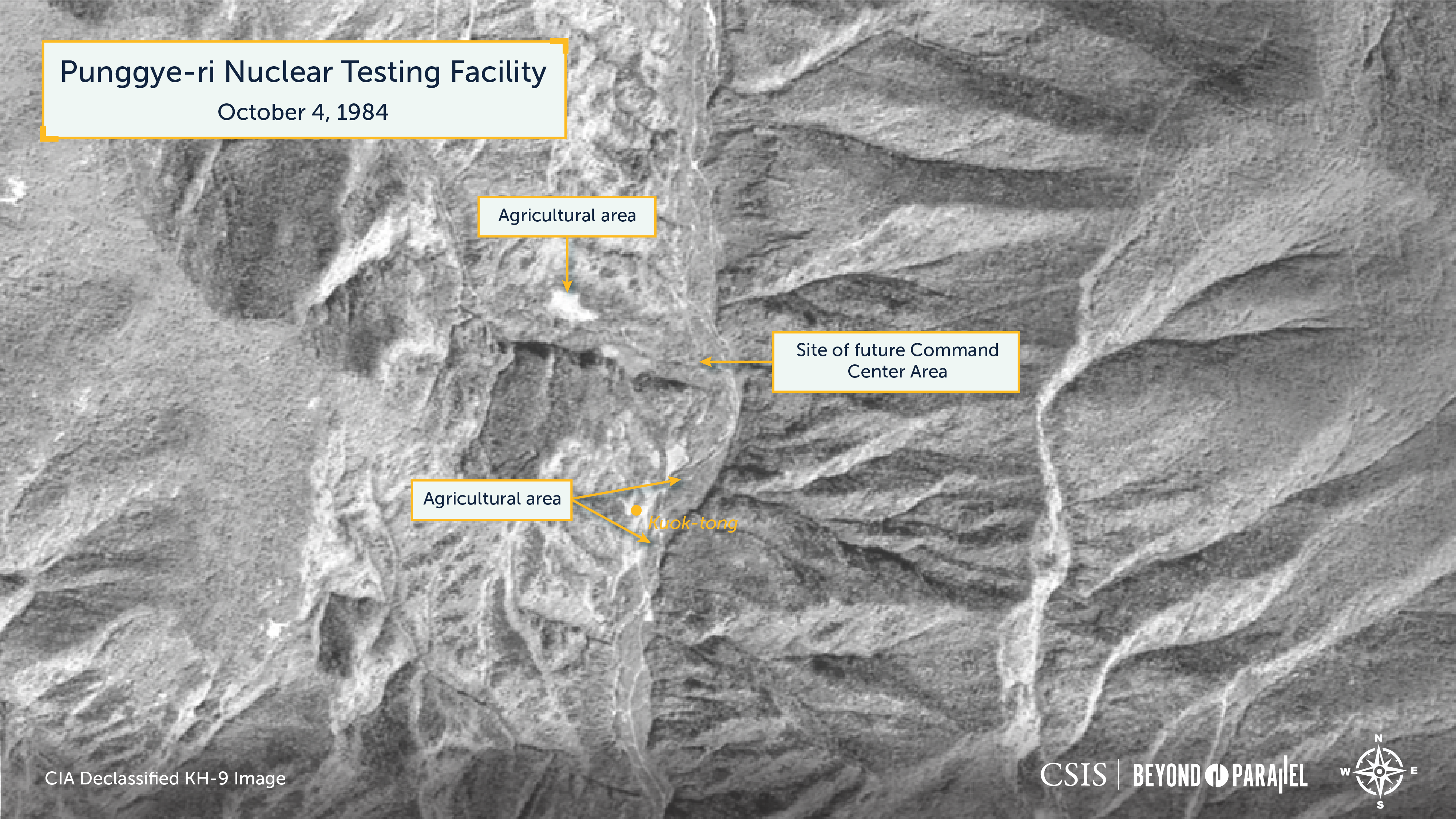
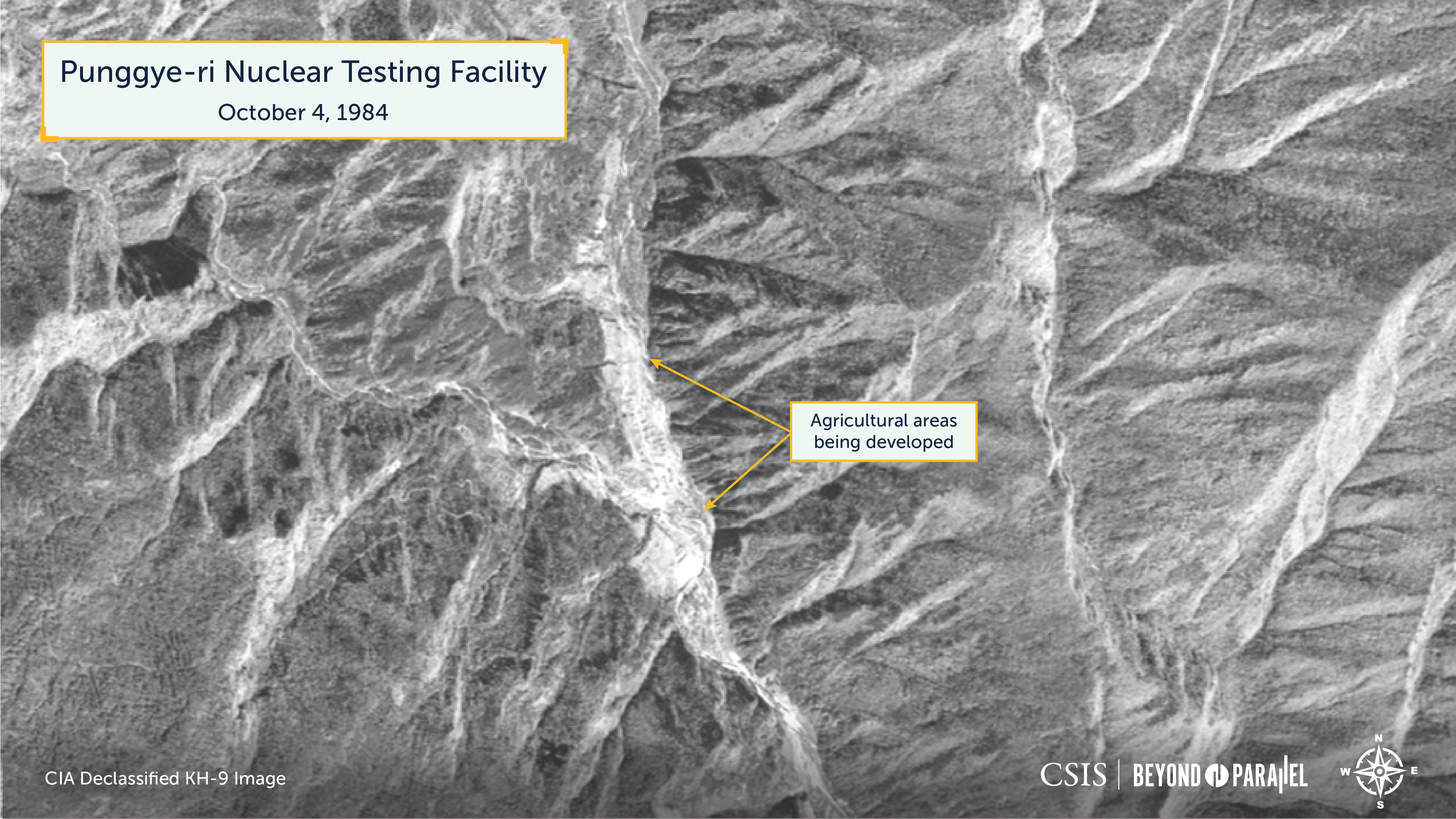
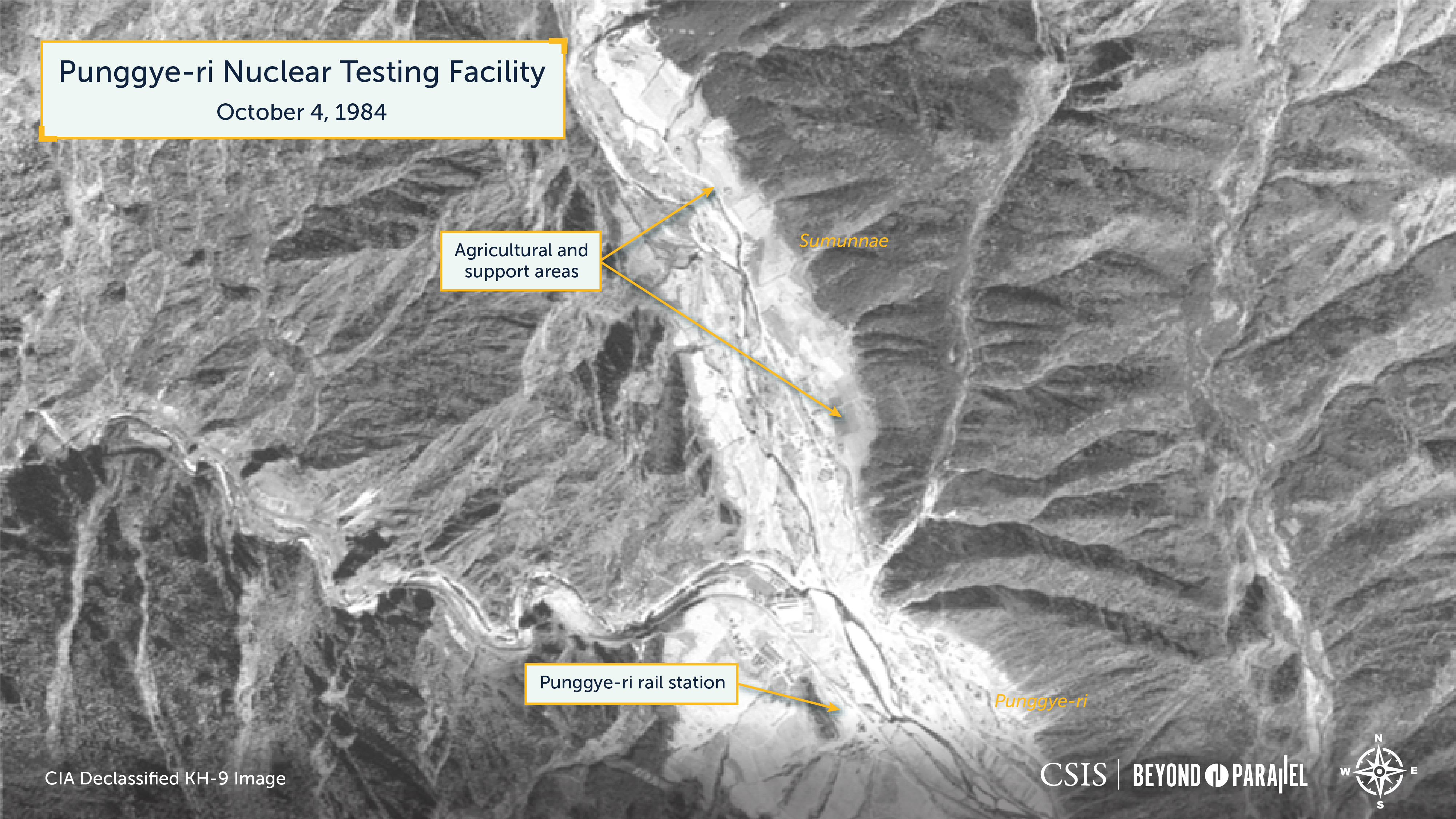
Two satellite images from 1984 and 1987 provide the opportunity to narrow down the probable timing for the commencement of construction to sometime between 1985 and 1986.2 The first is a declassified CIA satellite image acquired on October 4, 1984, by a KH-9 during mission 1219 launched on June 25, 1984. KH-9 imagery has a resolution of 60 centimeters to 1.2 meters depending on the look angle. The October 4, 1984, image is at the upper side of this range.
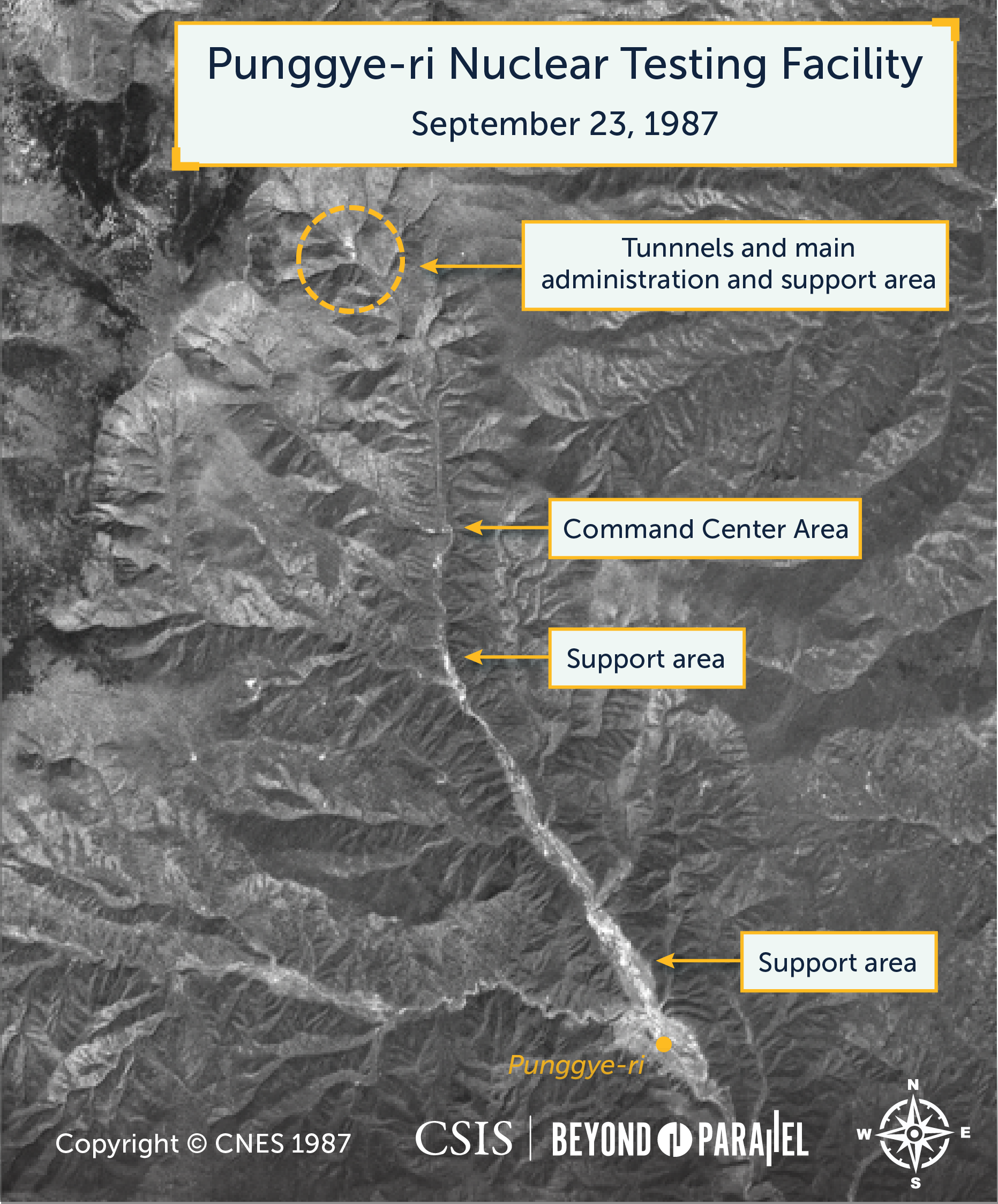
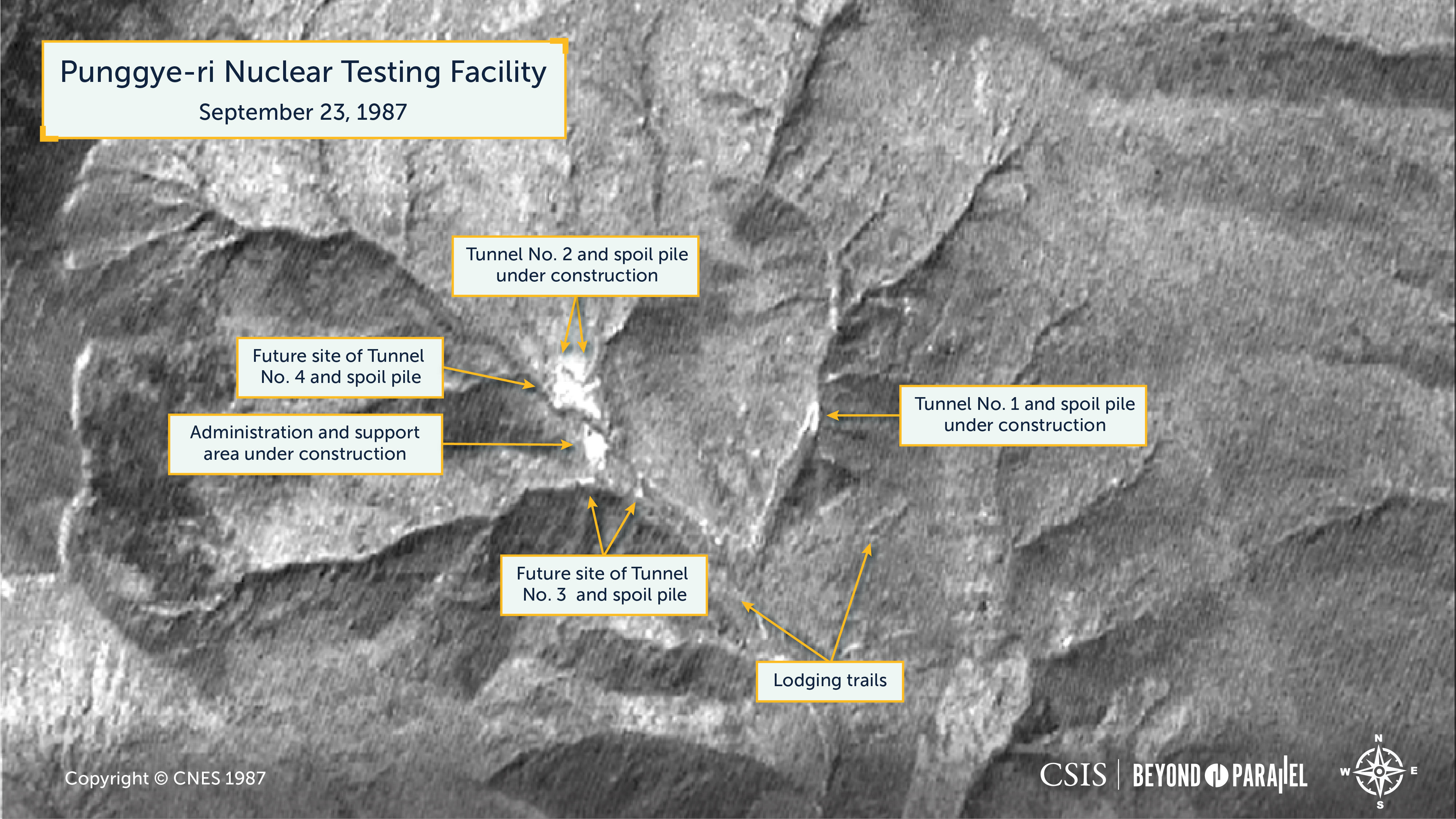
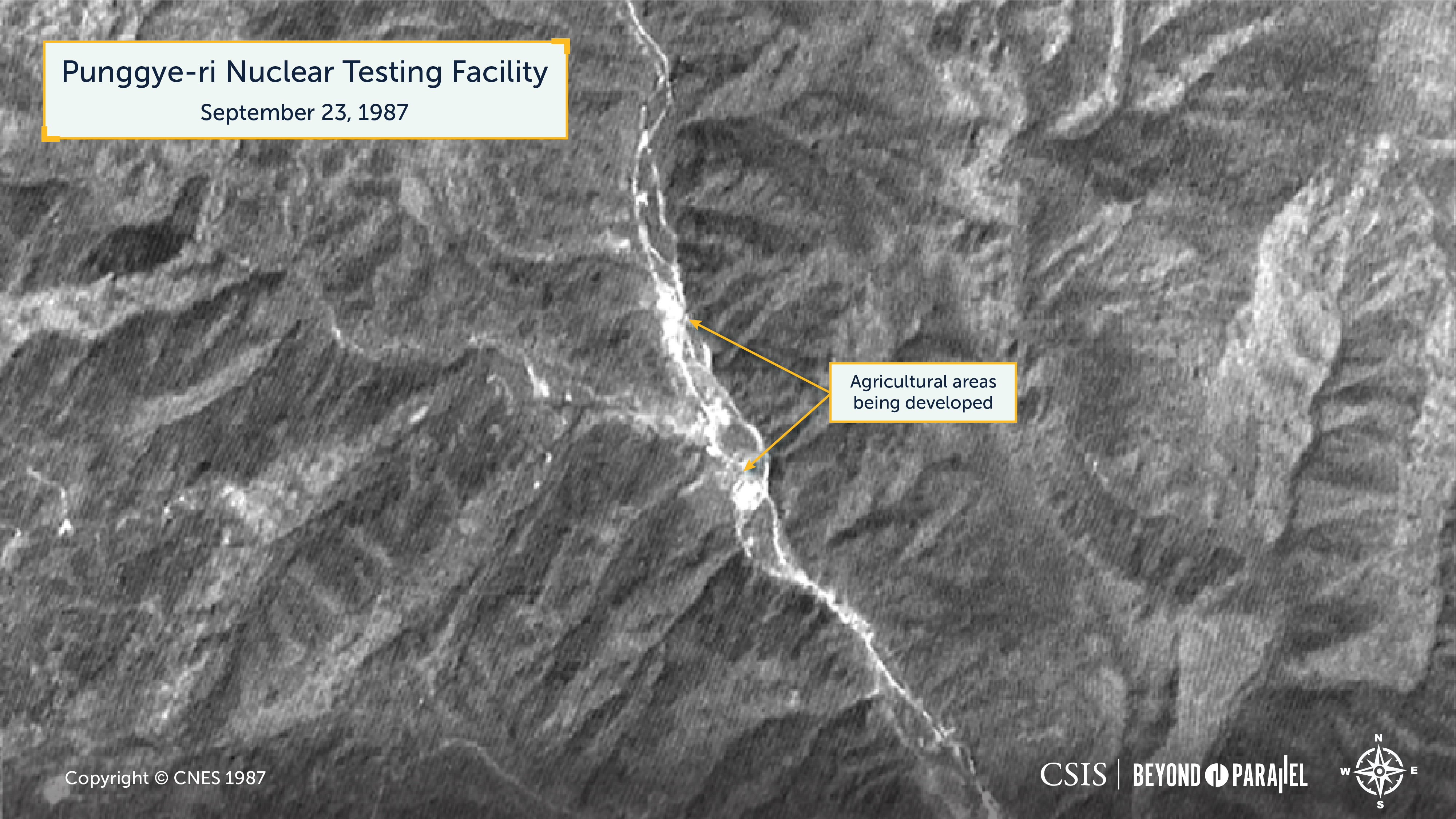
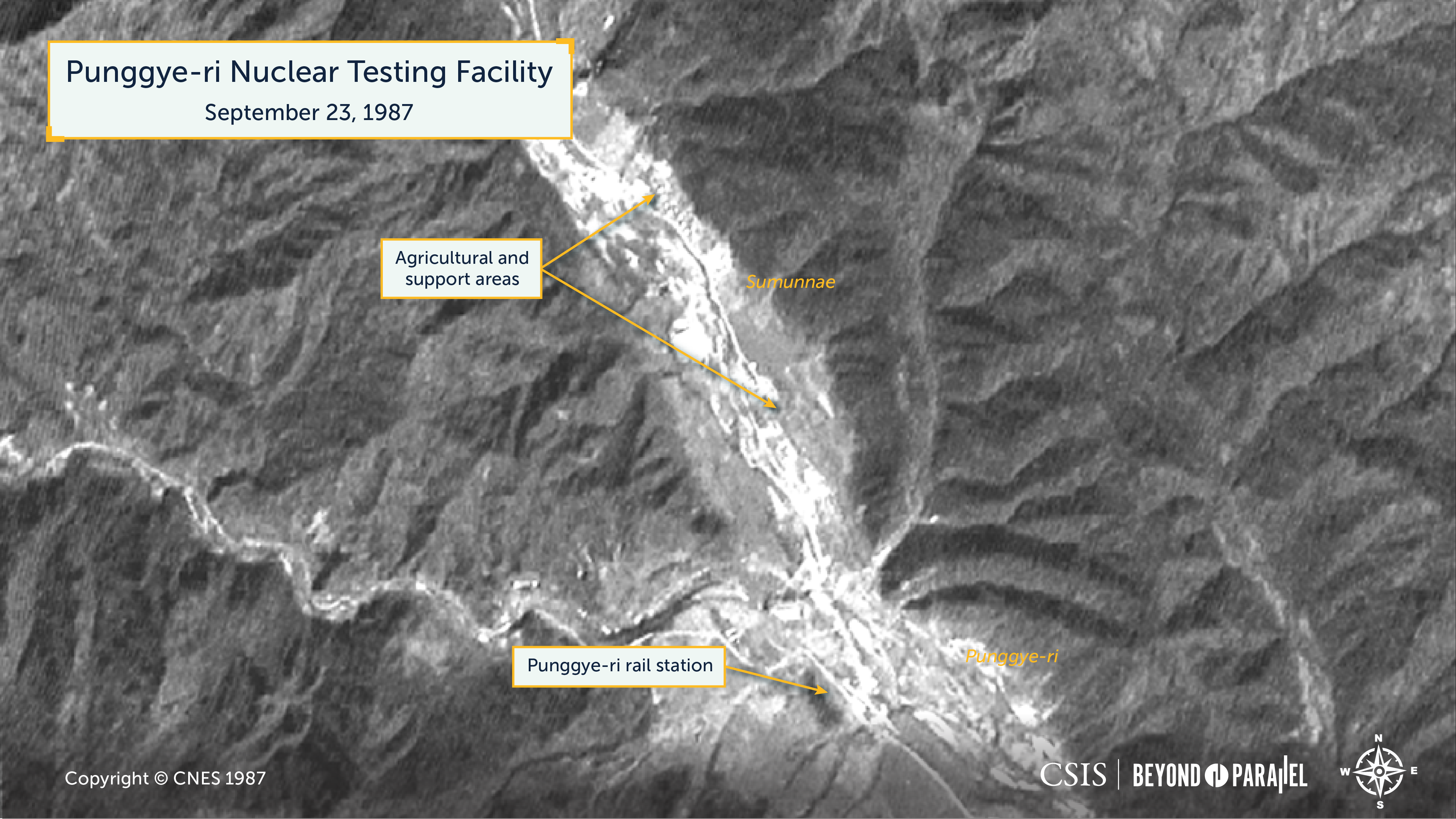
The second satellite image was acquired on September 23, 1987, by the French Centre National d’Etudes Spatiales (CNES) SPOT 1 satellite, which launched on February 22, 1986. The SPOT 1 satellite collected 10-meter panchromatic and 20-meter multispectral images. In the case of the February 22, 1986, image, only the 10-meter panchromatic was used.
The declassified KH-9 October 4, 1984, image shows numerous logging trails scattered around what would eventually become the northern test area of the Punggye-ri Nuclear Testing Facility. No evidence of facility construction or improved dirt roads is observed. Three years later, a commercial SPOT 1 image acquired on September 23, 1987, shows significant development having taken place during the intervening years. An improved dirt road was built within the branch valley on the eastern side of the facility along the west side of a stream leading to the portal of what would later become known as Tunnel No.1.
Additionally, significant tunnel excavation has occurred, as evidenced by the presence of a large spoil pile. Although likely present, the resolution of this image is insufficient to show any buildings. Within the western branch valley of the Testing Facility, excavation of what would become known as Tunnel No. 2 had begun, as is evident by a tailings pile that would grow considerably over time. Construction of the administration and support areas for the facility had also begun, as noted by the grading or excavation of the area. As with Tunnel No. 1, although likely present, the resolution of this image is insufficient to show any buildings at either location. Neither image shows evidence of the construction of Tunnels No. 3 or No. 4, which would be built later.
Approximately 6 kilometers south of the developing administration and support area is what would later become known as the Command Center Area. The declassified KH-9 October 4, 1984, image shows only small agricultural areas on the hill north and along the river around the small village of Kuok-tong. The September 23, 1987, image shows gradual development of agricultural support areas around the village of Kuok-tong, the initial stages of development for a housing area, and excavation for what would become the Command Center Area. Although likely present, the resolution of this image is insufficient to show any buildings.
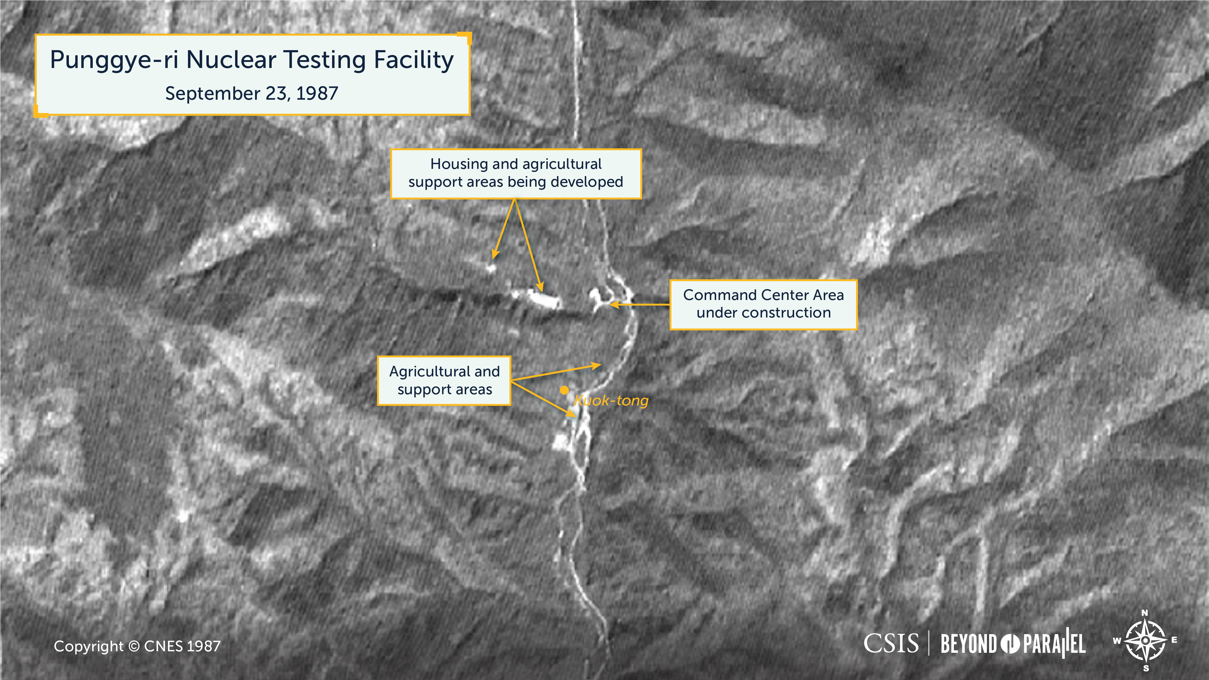
2.5 kilometers further south of Kuok-tong along the banks of the river, both images show dispersed agricultural activity, including several buildings. This area does not appear to have changed significantly between October 4, 1984, and September 23, 1987. These changes are probably the result of periodic flooding which altered in the course of the river.
At the southern end of the valley leading to the Punggye-ri Nuclear Testing Facility is the town of Punggye-ri, for which the Testing Facility is named. Immediately north of the town is the village of Sumunnae, which contains several agricultural and support facilities. While there appear to be some changes between October 4, 1984, and September 23, 1987, these changes may just as easily be attributed to the commencement of construction for the nuclear Testing Facility as to periodic flooding changing the course of the river.
How the Punggye-ri Nuclear Testing Facility continued to develop from 1987 until November 2, 2002—the date of one of the earliest high-resolution (1-meter or less) commercial satellite images—will likely have to be determined after the declassification of additional intelligence documents and satellite images.
It was from Tunnel No. 1 that North Korea conducted its first nuclear test some 20 years later, on October 9, 2006. While estimates of both its intended and actual yields vary considerably, it is known that Tunnel No. 1 was abandoned after this single test. The speculations as to why have likewise varied over the years, with the most probable being that the tunnel was simply only designed for single use or that there was a significant failure in the design of the tunnel that made future use untenable. Somewhat supporting the former assessment, the satellite imagery presented here shows that preliminary work on Tunnel No. 2 appears to have begun between 1984 and 1987. This tunnel was used for all five of North Korea’s subsequent nuclear tests.
References
- It should be noted that while the town of Punggye-ri is located within Hwasong-gun, Hamgyong-bukdo, the tunnels used for testing are within Orang-gun. ↩
- It is likely that a number of locations were initially considered as candidates for the Testing Facility and only after geological studies and surveying were undertaken was the Punggye-ri site selected. ↩
The post Punggye-ri Declassified: Birth of North Korea’s “Northern Nuclear Testing Site” appeared first on Beyond Parallel.


